

Ancient ridge roads and the upland geography of Wales
High above the valleys and market towns of Wales, a network of old tracks once crossed the hills in long, practical lines. These were the ridge roads, ancient upland routes that linked communities across difficult terrain long before modern highways cut through the landscape. In a country shaped by mountains, steep-sided valleys, and changeable weather, the ridgelines offered one of the few reliable corridors for movement. They were not roads in the modern sense, but rather paths of survival: narrow, weather-worn, and often invisible to those who do not know where to look.
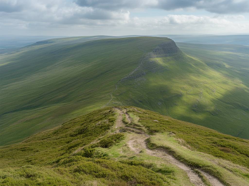
The importance of these upland routes lies in their geography. Wales is dominated by uplands, moorland, and mountain ranges such as the Cambrian Mountains, the Brecon Beacons, and Snowdonia. Travelling through valleys could mean detours, flooding, dense woodland, or control points held by local powers. Ridge roads, by contrast, followed the higher and drier ground. For merchants, shepherds, drovers, and messengers, these elevated routes could provide a faster and safer way to move between settlements, especially when the lowlands were marshy or politically fragmented.
Today, many of these ancient routes survive only as holloways, faint green lanes, field boundaries, or alignments preserved in the landscape. They may appear quiet and unremarkable, yet they once formed part of a broader transport system that supported trade, communication, and seasonal migration across medieval Wales and beyond.
Why ridge roads mattered in medieval and early modern Wales
The ridge roads of Wales were shaped by necessity. In an era before engineered bridges, tarmac, or drainage systems, the uplands often offered the most dependable route across a region. A ridge road could avoid boggy valley bottoms, river crossings, and the physical obstacles that slowed pack animals and traders. This made them especially valuable in a landscape where local routes could be cut off by heavy rain, snow, or conflict.
These routes were used for a range of purposes:
- moving livestock between summer grazing grounds and winter holdings
- carrying salt, wool, hides, grain, and metal goods
- linking small settlements, ecclesiastical sites, and regional markets
- supporting seasonal travel by drovers and itinerant workers
- providing strategic movement for local lords and messengers
In a predominantly rural society, road networks were often informal and shaped by repeated use. A track became established because it worked, and because generations of travellers reinforced it with their footsteps and cart wheels. Over time, these paths were incorporated into wider trade routes, many of them connecting Wales with border towns, English markets, and coastal exchange points. The survival of ridge roads therefore reflects not only geography, but also the practical intelligence of communities adapting to a demanding environment.
Trade across the uplands: pack animals, drovers, and local exchange
Trade in historical Wales was not limited to large centres or coastal ports. Much of it relied on modest, flexible transport systems that could function in mountainous terrain. Packhorses were especially important, since carts were often unsuitable for narrow, uneven, and steep tracks. A line of horses carrying wool, cloth, or salt could move more effectively along a ridge than a wheeled vehicle struggling through mud below.
Droving also played a central role in upland travel. Welsh livestock, especially cattle and sheep, were moved along long-distance routes to markets in England and within Wales itself. These journeys demanded reliable paths, access to water, and the ability to travel across open land. Ridge roads, with their panoramic visibility and firmer ground, were ideal for such movement. They also reduced the risk of getting trapped in valley bottlenecks or vulnerable crossing points.
Many products moved along these routes were essential to everyday survival. Salt preserved food. Wool supported textile production. Grain and local produce sustained households. Iron and tools allowed farming communities to maintain equipment and buildings. The old ridge roads of Wales were therefore part of an economic fabric that connected upland farms, village economies, and regional centres of exchange.
In some areas, trade routes followed older prehistoric alignments that had already linked hillforts, ritual sites, and defended settlements. The continuity is striking: later medieval and early modern traffic often reused older lines of movement because they were already embedded in the landscape. This is one reason ridge roads are important to historians and landscape archaeologists alike. They offer evidence of long-term human adaptation rather than isolated episodes of travel.
Survival in a harsh landscape: weather, conflict, and isolation
Wales has always demanded resilience from those who live and travel through it. The uplands can be exposed to wind, fog, frost, and sudden changes in weather. In such conditions, survival depended on knowing the land well. Ridge roads were useful not only because they were practical trade corridors, but because they helped communities stay connected when the environment itself became an obstacle.
During winter, flooded valleys and unstable river crossings could isolate farms and hamlets. In summer, high ground offered easier passage for animals and better visibility across the terrain. Travellers using ridge roads could navigate by landmarks, wood edges, cairns, and old boundary markers. The roads also helped people move quickly in times of tension or conflict, when lowland routes might be controlled, blocked, or dangerous.
The political history of Wales adds another layer of significance. For centuries, local lordships, marcher territories, and shifting borders affected movement. In some periods, the uplands provided a kind of neutral or less controlled space, where ancient paths remained useful because they were harder to monitor and easier to access discreetly. This made ridge roads important not only for commerce, but also for communication and local autonomy.
At the same time, these routes were not comfortable or easy. They demanded skill, endurance, and knowledge. Travellers needed to understand where the ground would hold, where streams could be crossed, and where shelter might be found. That practical knowledge was often passed down through families and communities, becoming part of the cultural memory of upland Wales.
Reading the landscape today: archaeology, heritage, and walking routes
Although many ridge roads have faded from use, they remain visible to those who know how to interpret the landscape. Archaeologists and historians identify them through earthworks, alignments, boundary ditches, worn surfaces, and documentary references. In some places, ancient ridgeways survive as public footpaths or walking trails. In others, they are only suggested by place names, straight lines on historic maps, or field patterns that preserve the memory of former movement.
For heritage tourism, these routes offer a distinctive way to explore Wales. They connect natural scenery with historical insight, allowing visitors to see the uplands not just as picturesque terrain, but as working landscapes shaped by transport, trade, and survival. Walking an old ridge road can reveal why communities settled where they did, how local economies functioned, and how difficult travel once was before modern roads transformed access.
Some of the most compelling features of these routes include:
- wide views across valleys and mountain ranges
- remnants of prehistoric and medieval trackways
- old boundary stones and enclosure lines
- links to historic market towns and droving centres
- evidence of seasonal movement and rural labour
Preserving these paths matters because they are part of Wales’s cultural and economic history. They are not simply scenic trails. They are archives in the landscape, recording how people moved, exchanged goods, and survived in a challenging environment. As tourism increasingly values authentic heritage experiences, ridge roads offer a powerful example of how history and landscape can be read together.
The enduring legacy of Wales’s forgotten upland routes
The forgotten ridge roads of Wales remind us that transport history is not only about great highways, railways, or bridges. It is also about smaller, older routes that served the everyday needs of rural life. These upland paths linked farms to markets, communities to each other, and travellers to the safest ground available. They supported trade, carried messages, and enabled survival in a landscape where distance, weather, and terrain could all become barriers.
What makes these roads especially compelling is their quiet endurance. Although many disappeared from regular use, their lines remain embedded in the hills. They continue to shape walking routes, local memory, and historical research. For visitors interested in Welsh history, ancient routes, and rural heritage, the ridge roads offer a deeper understanding of how people adapted to one of Britain’s most demanding environments.
To follow one of these old upland paths is to encounter Wales as a lived landscape rather than a static one. It is to see trade in motion, resilience in practice, and human ingenuity written across the hills. In that sense, the ridge roads of Wales are not forgotten at all. They remain present, if quietly, in the contours of the land and in the stories the land still holds.