The Welsh Drovers’ Roads: Ancient Routes That Connected People, Culture, and Landscape
The Welsh Drovers’ Roads: Ancient Routes That Connected People, Culture, and Landscape
The Welsh drovers’ roads form one of the most evocative but least-known chapters in the history of rural Europe. Long before railways or modern highways, these ancient routes stitched together remote valleys, market towns and ports, allowing people, animals and ideas to circulate across the rugged landscapes of Wales and beyond. Today, the surviving lanes, greenways and moorland tracks are a powerful attraction for cultural tourism, walking holidays and heritage travel, offering visitors a tangible way to experience the historic countryside of Wales.
What Were the Welsh Drovers’ Roads?
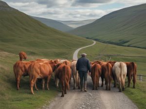
Drovers’ roads were long-distance routes used to move livestock—primarily cattle, but also sheep, pigs, geese and even turkeys—from rural pastures to urban markets. In Wales, these paths developed into a dense network of tracks and lanes stretching from the western seaboard and the upland farms of Snowdonia, Ceredigion and Carmarthenshire towards English market towns such as Hereford, Shrewsbury, Gloucester and London.
For centuries, Welsh drovers walked huge distances, driving hundreds of animals on foot. These journeys could take several weeks, with carefully planned overnight stops at farms, inns and safe grazing spots. The roads themselves were often unpaved, following natural contours along river valleys, over high passes or across open moorland. Over time, some routes became formalised as well-trodden trackways, sometimes later developed into turnpike roads.
In the broader European context, the Welsh drovers’ roads were part of a continental pattern of transhumance and cattle-trading routes, comparable to the transhumance paths of the Alps or the cattle trails of central France. Yet the Welsh system was distinctive for its scale, organisation and endurance, surviving well into the nineteenth century.
The Economic Lifeline of Rural Wales
The droving trade was a crucial economic lifeline for rural Welsh communities. In a landscape dominated by small farms and marginal upland pastures, raising livestock for export was often the most viable way to earn cash.
Welsh cattle, in particular, were prized for their hardiness. Bred in tough upland conditions, they could walk long distances and still arrive at market in good condition. From the sixteenth to the early nineteenth century, tens of thousands of animals were driven annually from Wales to English and sometimes Scottish markets, feeding expanding urban populations.
Along the drovers’ roads, a specialised rural economy developed. Farmers provided grazing and shelter; blacksmiths shod horses; inns supplied food, ale and overnight accommodation. Small Welsh towns—such as Llandovery, Rhayader and Bala—flourished as droving centres where deals were struck, information exchanged and local economies stimulated.
For modern visitors interested in cultural tourism and sustainable travel, tracing these drovers’ roads offers a way to understand how economic necessity shaped routes across the landscape. It reveals how Welsh agriculture, trade and mobility were interwoven long before industrialisation.
The Drover: A Professional of the Road
The figure of the Welsh drover occupies a special place in the social history of Britain. Drovers were not simply hired hands; many were respected professionals, trusted with valuable cargo over long distances.
To drive livestock safely across counties and borders required skill, patience and detailed geographical knowledge. Drovers had to understand grazing rights, river crossings and safe overnight stops, while also navigating local tolls and avoiding disease. They typically travelled in small groups for safety and efficiency.
By the eighteenth century, some Welsh drovers had acquired such a reputation for reliability that they were allowed to operate as informal bankers. They carried money between markets and rural communities, extended credit and sometimes facilitated remittances from migrants working in English cities back to their families in Wales. This role highlights how drovers’ roads were not just physical routes but channels of financial and social exchange.
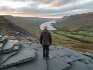
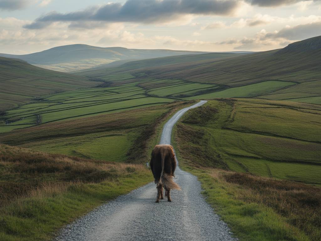
Routes Across a Distinctive Landscape
Geography shaped the pattern of the Welsh drovers’ roads. The combination of mountains, river valleys and coastal plains dictated the choice of pathways, many of which still define parts of the modern road and path network.
Some of the most historically significant routes include:
- The Tregaron to Abergwesyn road: Crossing the wild Cambrian Mountains, this remote upland track linked Ceredigion with the upper Wye Valley, passing over bleak moorland that remains sparsely populated today.
- The Bwlch-y-Groes pass: One of the highest public roads in Wales, connecting Gwynedd and Powys. Its steep ascent and dramatic views give a sense of the physical challenges drovers faced.
- The routes through Llandovery and Llandeilo: In Carmarthenshire, these towns became important centres for cattle sales and staging posts on journeys towards the English border.
- The Radnorshire tracks towards Hereford: Drovers from mid-Wales often headed east through Radnorshire, making use of relatively gentle terrain before crossing into the English counties and on to major market towns.
Many drovers’ roads followed old packhorse routes or possibly even older prehistoric trackways. They often avoided deep valleys where roads could become boggy or narrow, instead preferring ridges and open uplands where large herds could spread out and where visibility was good.
Inns, Churches and Meeting Places Along the Way
The social life of the drovers’ roads can still be read in the historic buildings and settlement patterns scattered along their course. Drovers’ inns were key institutions, strategically positioned at day’s-walk intervals, providing secure enclosures for animals and lodgings for the men.
Many of these inns survive today as country pubs, guest houses or private homes, especially in rural mid-Wales. They can often be recognised by extensive yards or paddocks, large stables and names that reference droving or cattle. For the heritage traveller, these buildings form an architectural record of the trade, linking local hospitality traditions to a wider European culture of coaching inns and roadside hostelries.
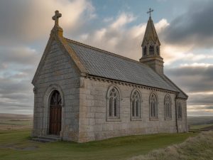
Churches and chapels also played a role. Some acquired special associations with drovers, who might attend services while on the road or make donations during prosperous years. Others stood as landmarks or safe places during bad weather. Over time, the drovers’ roads became lines along which religious ideas, nonconformist movements and later political messages could travel.
From Droving to Railways: The End of an Era
The decline of the Welsh drovers’ roads was closely tied to broader transformations in transport and agriculture across Europe. From the early nineteenth century, improvements in road surfaces, the introduction of toll-based turnpikes and then, critically, the arrival of the railways, changed how livestock moved.
Rail transport was faster, more predictable and less physically demanding on animals. New cattle markets developed near railway junctions, and livestock could be moved directly to urban centres without spending weeks on the hoof. At the same time, changes in land use, enclosure of common land and shifts in agricultural practice reduced the supply of semi-wild upland cattle that had once dominated Welsh exports.
By the late nineteenth century, large-scale droving from Wales to English markets had virtually disappeared. Some former drovers adapted, working in rail-based livestock trade or local farming; others lost a way of life that had defined rural Wales for generations.
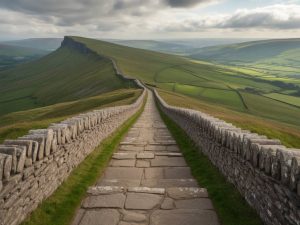
Walking the Drovers’ Roads Today
For modern visitors, the remnants of the drovers’ network offer a compelling way to explore Wales, combining landscape appreciation, local history and slow travel. Heritage tourism has increasingly embraced these routes, promoting them as long-distance walking and cycling trails.
Many drovers’ roads now form parts of well-known recreational paths, such as sections of the Cambrian Way, Glyndŵr’s Way and various regional trails. While the original function of the roads has vanished, the routes still provide:
- Access to remote scenery: Upland sections cross quiet moors, heather-covered ridges and open commons that retain a sense of historical isolation.
- Connections between small communities: Walkers can trace the same links between villages and market towns that drovers once used, gaining insight into rural settlement patterns.
- Opportunities for sustainable tourism: Walking and cycling along these historic routes supports local accommodation providers, pubs and heritage attractions without placing heavy pressure on the environment.
- Educational value: Interpretation boards, guidebooks and local museums increasingly highlight the droving heritage, encouraging visitors to engage with Welsh culture, language and rural traditions.
Travelling these roads on foot or by bicycle often reveals subtle landscape features: old boundary stones, holloways worn deep by centuries of hooves, and crossing points where fords have given way to bridges. These traces help bring the history of the drovers to life in a way that written records alone cannot.
Interpreting the Drovers’ Roads in a European Context
The story of the Welsh drovers’ roads resonates with wider European themes of mobility, rural economies and the shaping of landscapes by traditional practices. Like the transhumance paths of Spain’s cañadas or the pastoral routes of the Italian Apennines, these Welsh routes demonstrate how movement was once central to rural livelihoods.
They also illustrate how pre-industrial societies overcame geographic barriers. In a country of mountains and scattered settlements, drovers’ roads transformed difficult terrain into commercial opportunity. The routes linked Welsh-speaking communities with English market towns, making them channels for cultural contact, linguistic exchange and economic integration within the British and wider European economy.
For historians, geographers and tourists alike, the drovers’ legacy offers a lens through which to examine questions of identity, adaptation and resilience. It shows how local traditions can interact with broader economic forces, and how seemingly marginal landscapes can be central to long-distance trade networks.
Planning a Cultural Journey Along the Drovers’ Roads
For travellers interested in European history, rural heritage and walking holidays, planning a journey along sections of the Welsh drovers’ roads can be an enriching experience. Practical considerations include:
- Researching local routes: Many regional tourist offices and walking guides identify former drovers’ tracks, especially in mid-Wales. Maps and guidebooks often highlight old lanes and greenways associated with droving.
- Staying in historic inns: Choosing accommodation in former drovers’ inns or traditional market towns helps connect the journey with its historic context.
- Combining walking with visits to museums: Local museums in towns such as Llandovery, Brecon or Dolgellau often include exhibits on droving, agriculture and rural crafts.
- Engaging with local culture: Attending agricultural shows, livestock markets or community events can offer modern echoes of the social networks that once depended on the drovers’ roads.
In an age when many travellers seek authentic, place-based experiences, the Welsh drovers’ roads offer a compelling narrative route: an invitation to walk slowly through history, to read the landscape as a text, and to reflect on how people, culture and environment have long been intertwined in this part of Europe.